
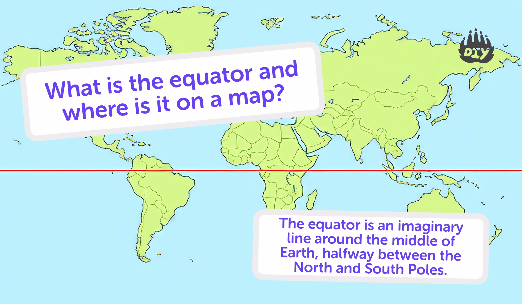
When studying geography, one line shows up again and again: the Equator. It looks simple just a line circling the globe. But it’s one of the most important features in Earth science.
Why Kids Learn About the Equator
The Equator helps us understand weather, seasons, maps, and how the planet is divided. That’s why kids in grades 3–6 often get homework questions like: What is the Equator? Where is it on a map?
If your child is working on geography homework, the AI Homework Helper can give clear answers, quizzes, and safe practice questions to build confidence.
What Is the Equator?
The Equator is an imaginary line that circles Earth horizontally, dividing it into the Northern Hemisphere and the Southern Hemisphere. Think of it like Earth’s “belt,” wrapping around the middle of the planet.
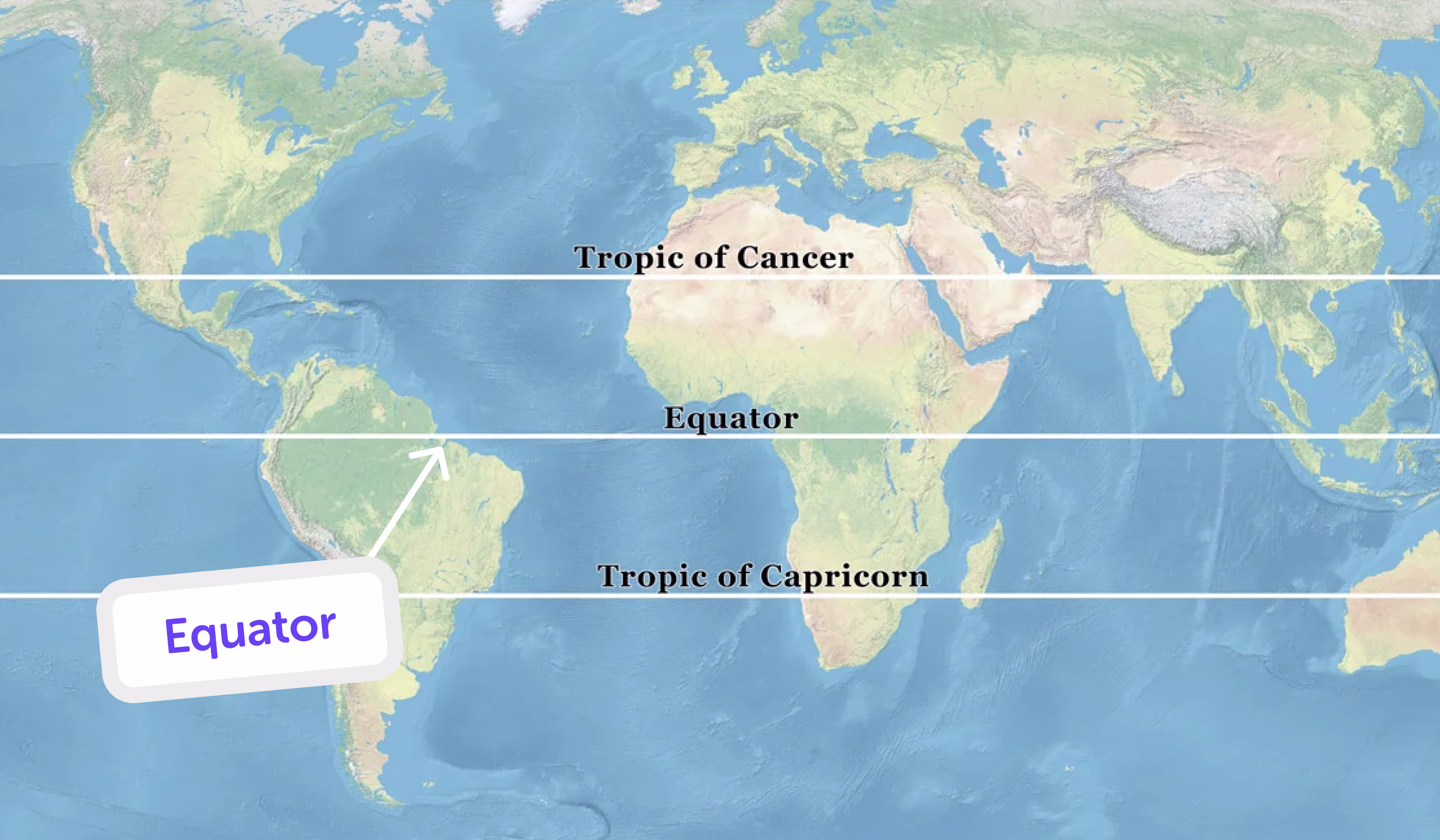
It’s at 0 degrees latitude.
It measures about 24,901 miles (40,075 kilometers) long.
It crosses continents like South America, Africa, and Asia.
Where Can You See the Equator on a Map?
On any world map or globe, the Equator appears as a bold horizontal line across the middle. It circles Earth’s widest part and passes through 13 countries, including Ecuador, Brazil, Kenya, Uganda, and Indonesia. Places along this line get nearly equal daylight and nighttime year-round. On a classroom globe, trace the Equator with your finger you’ll feel how it wraps all the way around the planet.
👉 Try asking the DIY.org homework helper tool: “Which countries does the Equator cross?”
Why Is the Equator Important?
The Equator affects:
Climate: Areas near the Equator are usually hot and humid, with tropical rainforests.
Seasons: Unlike other places, equatorial regions don’t have four distinct seasons, they usually have wet and dry seasons.
Navigation: Sailors and pilots use the Equator as a key reference point.
Geography: It’s the starting point for measuring latitude (north and south).
Countries on the Equator
The Equator crosses parts of South America, Africa, and Asia. Use this list to spot them quickly on a map or globe.
South America:
Ecuador, Colombia, Brazil
Africa:
Gabon, Republic of the Congo, Democratic Republic of the Congo, Uganda, Kenya, Somalia, São Tomé and Príncipe
Asia:
Indonesia, Maldives (close to the Equator)
Fun fact: The country Ecuador is named after the Equator.
The Equator connects to things kids already know
Tropical fruits like bananas and pineapples grow near the Equator.
Animals like toucans, gorillas, and jaguars live in equatorial rainforests.
Travel photos of beaches in Indonesia, Brazil, or Kenya often show sunny equatorial weather.
👉 Ask the DIY.org homework helper tool: “What animals live near the Equator?”
Fun Facts About the Equator
At the Equator, Earth spins fastest, about 1,037 miles per hour!
Day and night are almost the same length every day of the year.
The Galápagos Islands (on the Equator) inspired Charles Darwin’s theory of evolution.
In Quito, Ecuador, you can stand with one foot in the Northern Hemisphere and the other in the Southern Hemisphere.
Tips for Parents Helping With Geography Homework
Use a globe or map: Let kids physically trace the Equator line.
Connect to climate: Talk about how hot places like Brazil differ from cooler places far north or south.
Make comparisons: Ask your child why Alaska has snow but Kenya (on the Equator) is warm year-round.
Practice quizzes: Use the AI Homework Helper to generate practice geography questions.
Frequently Asked Questions about Equator
What is the Equator in simple words?
The Equator is an imaginary line that divides Earth into the Northern and Southern Hemispheres.
Why is the Equator hot?
Because the sun’s rays hit Earth most directly at the Equator.
Does the Equator move?
No, it’s a fixed imaginary line at 0° latitude.
Which oceans does the Equator cross?
The Atlantic, Indian, and Pacific Oceans.
Can you visit the Equator?
Yes! There are monuments and tourist sites in countries like Ecuador and Kenya.
How long is the Equator?
About 24,901 miles (40,075 kilometers).
The Equator’s Role in Our World
The Equator is one of Earth’s most important lines, dividing the globe into two halves and shaping climates, seasons, and ecosystems.
For kids, understanding the Equator makes geography homework come alive it connects maps to real-world places, animals, and cultures. And with the DIY.org homework helper tool, children can safely explore questions, take practice quizzes, and strengthen their geography knowledge.
