
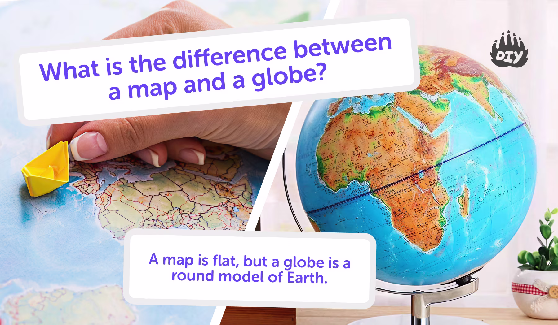
A map is a flat drawing of Earth, while a globe is a round model that shows what our planet really looks like. Both help us learn about countries, oceans, and places but in different ways. Let’s explore how maps and globes work, and which one helps kids understand geography best.
When studying geography, kids often use both maps and globes. They may look similar, both show Earth, but they are actually quite different tools.
Why Kids Learn About Maps and Globes
Homework questions often ask: What is the difference between a map and a globe? Learning this helps kids understand how we represent the round Earth in different ways.
For clear explanations and extra practice, the AI Homework Helper is a safe way for children to explore maps and globes in more detail.
At a Glance (Quick Comparison)
Feature | Map | Globe |
Shape | Flat | Round (3D) |
Best for | Streets, countries, travel routes, themes (weather, population) | Understanding Earth’s shape, continents, oceans, true distances |
Scale | Can zoom in or out easily | Fixed size |
Accuracy | Shapes/distances can stretch near edges | Very accurate overall |
Convenience | Lightweight, printable, easy to carry | Bulkier, not as portable |
What is a map?
A map is a picture of Earth drawn on a flat surface. Some maps show where things are (political maps). Others show what is happening in a place like rainfall, population, or landforms. Because a map is flat, cartographers use different projections (ways to draw Earth) that can slightly distort size or shape.
Kid tip: If you want to find a street, a park, or plan a road trip, start with a map.
What Is a Globe?
A globe is a small, round 3D model of Earth. Because it’s spherical, it shows continents and oceans in their true shapes and relative sizes. Most globes spin on an axis, just like the real Earth. They’re highly accurate for distance and direction, but they usually include less detail than maps.
Why globes are useful
True shapes and sizes of land and water
Correct directions and distances over long routes
A clear view of how the whole planet fits together
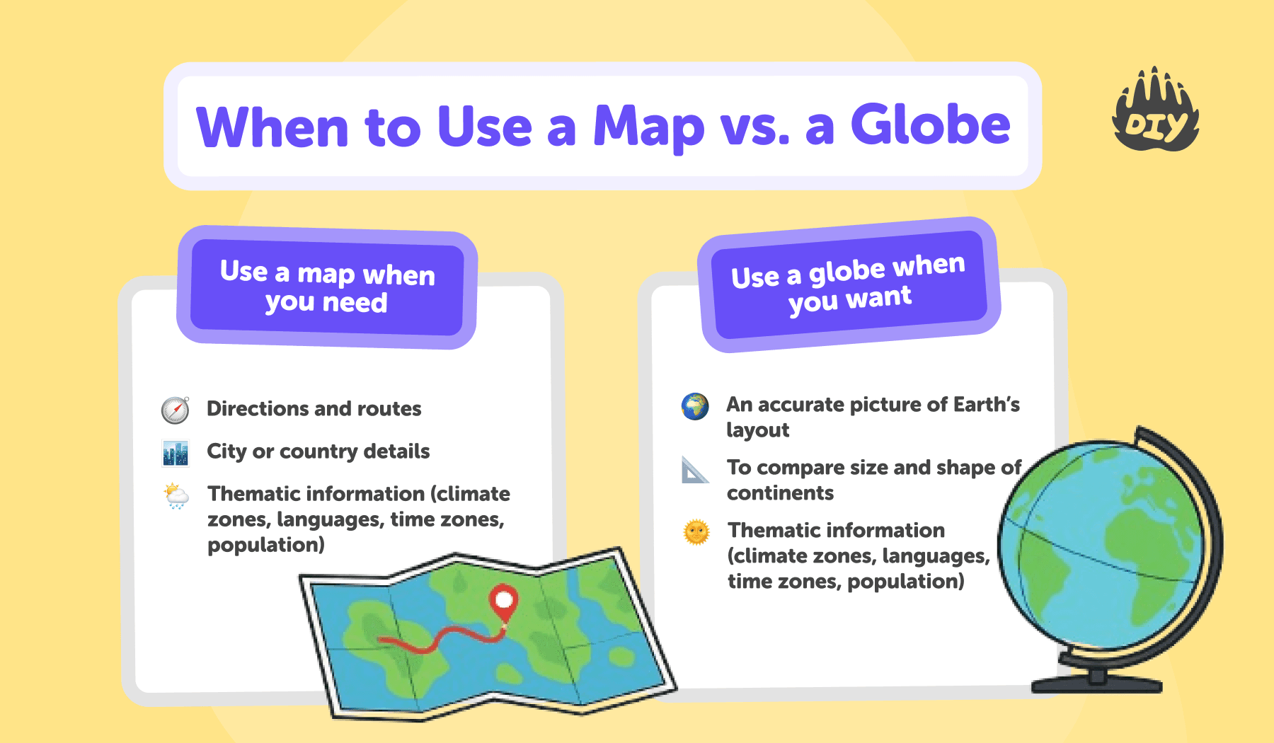
When to Use a Map vs. a Globe
Use a map when you need:
Directions and routes
City or country details
Thematic information (climate zones, languages, time zones, population)
Use a globe when you want:
An accurate picture of Earth’s layout
To compare size and shape of continents
To understand how the planet spins and why we have day and night
Use a map when you need detail or directions. Choose a globe when you want accuracy over long distances or to compare the true size and position of places.
👉 Ask the DIY.org homework helper tool: “Why do maps sometimes make Greenland look too big?”
Simple Activities for Kids
Map hunt
Find your city on a world map, then zoom in to a street map and locate your school.
Globe spin
Spin a globe, stop with your finger, and learn one new fact about the place you land on.
Distance check
Measure the distance between two cities on a globe with a string; compare it with a map.
Projection challenge
Look up two different world maps (e.g., Mercator vs. Robinson). What looks bigger or smaller?
Why We Need Both Maps and Globes
Maps are better when we need detail, like reading a subway system. Globes are better when we want accuracy, like comparing the size of Africa and Europe. Together, they give us both big-picture and close-up views of the world.
Where We See Maps and Globes in Everyday Life
Maps show up everywhere on your phone’s map app, in video games, at parks and museums, and on road-trip dashboards. Globes are common in classrooms and libraries, and you’ll often spot them in offices or as décor at home. Both help kids understand where they are, how countries connect, and why distances and directions matter.
Quick examples for kids:
Checking the best route to school on a map app
Exploring a new game world with an in-game mini-map
Finding continents and oceans on a classroom globe
Comparing how far two countries are globe for accuracy, map for details
Fun Facts About Maps and Globes
The oldest known maps are carved on clay tablets over 4,000 years old.
The word “atlas” is used for a book of maps.
The first globes were made in Ancient Greece.
Some modern maps are interactive like Google Maps.
👉 Ask the AI Homework Helper: “Who made the first globe?”
Tips for Parents Helping With Geography Homework
Show both together: Let kids compare a world map and a globe side by side.
Explain distortions: Show how continents look different on a map versus a globe.
Connect to travel: Use maps for road trips and globes for big-picture learning.
Encourage practice: The AI Homework Helper can quiz kids on continents and oceans.
Questions about maps and globes
What is a map?
A flat drawing of Earth or part of Earth.
What is a globe?
A round model of Earth showing continents and oceans.
Which is more accurate?
Globes, because they match Earth’s round shape.
Which is easier to use for details?
Maps, because they can zoom in to show small areas.
Why do we still use both?
Maps give detail, globes give accuracy. Together, they’re the perfect pair.
Can maps be digital?
Yes, apps like Google Maps are digital maps.
Understanding Earth with Maps & Globes
Maps and globes both represent Earth but in different ways. Maps are flat and detailed, while globes are round and accurate.
For kids, learning the difference helps them understand geography tools better. And with the DIY.org homework helper tool, they can explore maps, globes, and directions safely while building confidence in their schoolwork.
Try the AI Homework Helper for Kids to ask geography questions, check understanding, and get step-by-step help.
