Geostationary Orbit Facts For Kids
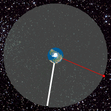
A geostationary orbit is a circular path in space where a satellite remains constantly above the same point on Earth's equator, orbiting at an altitude of 35,786 kilometers.

Do more with AI
Introduction
Have you ever looked up at the sky and wondered about the satellites that help us send messages and watch TV? 📡That's where geostationary orbits come in! A geostationary orbit is a special path that satellites follow in space, 35,786 kilometers (about 22,236 miles) above Earth's equator. 🌍These satellites go around the Earth at the same speed that the Earth spins, making them appear to stay in one spot in the sky! This helps them be super useful for things like communication and weather forecasting. Isn't that cool? 🛰️✨
Images of Geostationary Orbit

A 5° × 6° view of a part of the geostationary belt, showing several geostationary satellites. Those with inclination 0° form a diagonal belt across the image; a few objects with small inclinations to the Equator are visible above this line. The satellites are pinpoint, while stars have created star trails due to Earth's rotation.

Syncom 2, the first geosynchronous satellite
![Service areas of satellite-based augmentation systems (SBAS).[20]](https://upload.wikimedia.org/wikipedia/commons/thumb/4/46/SBAS_Service_Areas.png/500px-SBAS_Service_Areas.png)
Service areas of satellite-based augmentation systems (SBAS).[20]


A computer-generated image from 2005 showing the distribution of mostly space debris in geocentric orbit with two areas of concentration: geostationary orbit and low Earth orbit.
![Comparison of geostationary Earth orbit with GPS, GLONASS, Galileo and Compass (medium Earth orbit) satellite navigation system orbits with the International Space Station, Hubble Space Telescope and Iridium constellation orbits, and the nominal size of the Earth.[b] The Moon's orbit is around 9 times larger (in radius and length) than geostationary orbit.[c]](https://upload.wikimedia.org/wikipedia/commons/thumb/b/b4/Comparison_satellite_navigation_orbits.svg/500px-Comparison_satellite_navigation_orbits.svg.png)
Comparison of geostationary Earth orbit with GPS, GLONASS, Galileo and Compass (medium Earth orbit) satellite navigation system orbits with the International Space Station, Hubble Space Telescope and Iridium constellation orbits, and the nominal size of the Earth.[b] The Moon's orbit is around 9 times larger (in radius and length) than geostationary orbit.[c]
A 5° × 6° view of a part of the geostationary belt, showing several geostationary satellites. Those with inclination 0° form a diagonal belt across the image; a few objects with small inclinations to the Equator are visible above this line. The satellites are pinpoint, while stars have created star trails due to Earth's rotation.
Syncom 2, the first geosynchronous satellite
Service areas of satellite-based augmentation systems (SBAS).[20]
A computer-generated image from 2005 showing the distribution of mostly space debris in geocentric orbit with two areas of concentration: geostationary orbit and low Earth orbit.
Comparison of geostationary Earth orbit with GPS, GLONASS, Galileo and Compass (medium Earth orbit) satellite navigation system orbits with the International Space Station, Hubble Space Telescope and Iridium constellation orbits, and the nominal size of the Earth.[b] The Moon's orbit is around 9 times larger (in radius and length) than geostationary orbit.[c]
Key Satellites In Geostationary Orbit
There are many important satellites in geostationary orbit that help us every day! 📡One of the most famous is the Intelsat series, which helps with internet and phone services worldwide. 🌐Another important one is the SES-10, known for improving broadcast services! 🌍For weather, the GOES satellites—like GOES-16 and GOES-17—keep an eye on conditions in the U.S. and share data with weather stations! ☁️ Each satellite plays a special role, helping us stay informed and connected! 🚀
Future Trends In Geostationary Orbit Technology
The future of geostationary orbit technology looks exciting! 🚀Engineers are always working on making satellites better. For instance, new satellites might use advanced antennas to send stronger signals. 📡They're also exploring new energy sources, like solar power, to keep the satellites running longer. 🌞Additionally, scientists are studying ways to reduce space debris, making space safer for satellites! As technology evolves, we might even create satellites that could help us explore other planets! 🌌🔭
Geostationary Satellites And Weather Monitoring
Geostationary satellites are fantastic for weather monitoring! 🌦️ They can take pictures of clouds, rain, and storms from space. 📸This helps meteorologists—people who study the weather—to predict storms and share important information. For example, the GOES (Geostationary Operational Environmental Satellite) system helps keep an eye on weather patterns in the United States. 🌪️ With these satellites, we can prepare for extreme weather like hurricanes and keep everyone safe! 🌈
History And Development Of Geostationary Satellites
The idea of geostationary satellites was first thought of by a writer named Arthur C. Clarke in 1945! 🤔He imagined three satellites helping with global communication. Then, the first real geostationary satellite, named Syncom 3, launched in 1964. 🚀It showed live coverage of the Olympic Games! Since then, many satellites have been sent to geostationary orbit, improving the way we talk and send information around the world. Today, there are more than 400 geostationary satellites soaring in space! 🌌
Comparison Of Geostationary And Geosynchronous Orbits
While both geostationary and geosynchronous orbits sound similar, they have a few differences! 📊A geosynchronous satellite moves in a path that matches Earth's rotation, but it may change position in the sky. In contrast, a geostationary satellite stays over the same spot above the equator. 🌏This makes geostationary satellites perfect for communications and weather monitoring! Geosynchronous satellites can also move over different parts of Earth. They both help us understand our world better! 🌈
Definition And Characteristics Of Geostationary Orbit
A geostationary orbit is a special orbit where satellites move at a circular path above the equator. 🌎They sit at a height of 35,786 kilometers (22,236 miles) from Earth's surface! These satellites match the Earth's rotation, circling our planet once every 24 hours. ⏰Because of this, they always look down on the same spot! This makes them perfect for tracking weather or helping with TV signals. What’s even cooler is that they're always above the same point, so we can find them easily! 🌈
Impact Of Geostationary Orbits On Global Communication
Geostationary orbits have changed the way we communicate across the globe! 🌍📱 These satellites help people make phone calls, send emails, and watch television from miles away. When you call a friend in another country, that signal may travel through a geostationary satellite! 🌐This connects us all, no matter how far apart we are. They also make live events like concerts and sports games available for everyone. Thanks to these satellites, the world feels smaller and more connected! 🎉📺
Applications Of Geostationary Orbit In Telecommunications
Geostationary satellites are very important for telecommunications! 📞They help transmit TV signals, internet, and even radio communications. This means when you watch your favorite show, it might come from a satellite in geostationary orbit! 🎥These satellites cover a broad area on Earth, allowing people to connect easily. They can send messages and calls without wires. Imagine playing a video game and connecting with friends far away—that's thanks to these satellites! 🎮🌐
Technical Challenges In Maintaining A Geostationary Orbit
Keeping satellites in a geostationary orbit can be tricky! ⚙️ One challenge is the pull of gravity from the Moon and Sun, which can disrupt the satellite's path. 🌙☀️ To fix this, satellites have thrusters that help adjust their position. Another challenge is the risk of space junk, which can collide with the satellite. 💥Engineers must carefully plan the satellites’ paths and regularly check them to keep them safe in space! It's like playing a game of dodgeball, but way up high! 🎈
Global Coverage And Limitations Of Geostationary Satellites
Geostationary satellites can cover a large part of the Earth, but there are some limits! 🌍Since these satellites are positioned above the equator, they can only see areas close to it. This means that places far north or south might not get a signal. For example, if you live in Canada, you may have fewer geostationary satellites directly overhead! 🚫🌨️ However, different satellites can help fill in these gaps to improve coverage, working together like a team to connect the world! 🤝
Geostationary Orbit Quiz
Learn more about Geostationary Orbit
