Makalu Facts For Kids
Makalu is a towering peak in the Himalayas, renowned for its challenging climbs and breathtaking beauty.


Do more with AI
Introduction
Makalu is the fifth-highest mountain in the world, standing at 8,485 meters (27,838 feet) above sea level! 🌍It’s located in the Himalayas, on the border between Nepal and the Tibet region of China. Makalu is known for its pyramid shape, which makes it unique! 🏔️ The mountain is part of the Mahalangur Himal, a group of mountains that includes Mount Everest. The first people to reach the top of Makalu were Americans, who accomplished this on May 15, 1955. ✨Climbing Makalu is tough but exciting for many adventurers around the globe!
Images of Makalu


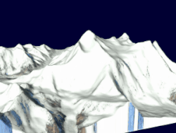
Makalu 3D
![NASA pan photo mosaic of the Himalayas with Makalu and Mount Everest . The photo mosaic uses photos ISS008-E-13302 TO 13307 taken 28 January 2004 taken from the International Space Station, Expedition 8 and added to The Gateway to Astronaut Photography. From The Gateway to Astronaut Photography of Earth "On Top of the World: Everest and Makalu: Astronauts on board the International Space Station (ISS) have a unique view of the world because of their position in a low orbit (200 nautical miles, 360 km) relative to satellites and their ability to look at any angle out the windows of the spacecraft. ISS crewmembers recently took advantage of their vantage point to photograph a series of oblique views of the Himalayas looking south from over the Tibetan Plateau . At first glance, one might think that the image looks like a picture taken from an airplane, until you remember that the summits of Makalu [left (8,462 meters; 27,765 feet)] and Everest [right (8,850 meters; 29,035 feet)] are at the heights typically flown by commercial aircraft. The full mosaic covers over 130 kilometers (80 miles) of the Himalayan front, and could never be seen this way from an airplane. The image is part of a larger panorama mosaic of the Himalayas that can be interactively viewed. The popular Find Mt. Everest feature is used to train astronauts to be able to find the peak in a few seconds as they pass over the Himalayas."](https://upload.wikimedia.org/wikipedia/commons/thumb/6/6d/EverestMosaic.jpg/500px-EverestMosaic.jpg)
NASA pan photo mosaic of the Himalayas with Makalu and Mount Everest . The photo mosaic uses photos ISS008-E-13302 TO 13307 taken 28 January 2004 taken from the International Space Station, Expedition 8 and added to The Gateway to Astronaut Photography. From The Gateway to Astronaut Photography of Earth "On Top of the World: Everest and Makalu: Astronauts on board the International Space Station (ISS) have a unique view of the world because of their position in a low orbit (200 nautical miles, 360 km) relative to satellites and their ability to look at any angle out the windows of the spacecraft. ISS crewmembers recently took advantage of their vantage point to photograph a series of oblique views of the Himalayas looking south from over the Tibetan Plateau . At first glance, one might think that the image looks like a picture taken from an airplane, until you remember that the summits of Makalu [left (8,462 meters; 27,765 feet)] and Everest [right (8,850 meters; 29,035 feet)] are at the heights typically flown by commercial aircraft. The full mosaic covers over 130 kilometers (80 miles) of the Himalayan front, and could never be seen this way from an airplane. The image is part of a larger panorama mosaic of the Himalayas that can be interactively viewed. The popular Find Mt. Everest feature is used to train astronauts to be able to find the peak in a few seconds as they pass over the Himalayas."

Makalu-Barun Valley – A glacier valley starting from the foot of the Makalu.

Makalu 3D
NASA pan photo mosaic of the Himalayas with Makalu and Mount Everest . The photo mosaic uses photos ISS008-E-13302 TO 13307 taken 28 January 2004 taken from the International Space Station, Expedition 8 and added to The Gateway to Astronaut Photography. From The Gateway to Astronaut Photography of Earth "On Top of the World: Everest and Makalu: Astronauts on board the International Space Station (ISS) have a unique view of the world because of their position in a low orbit (200 nautical miles, 360 km) relative to satellites and their ability to look at any angle out the windows of the spacecraft. ISS crewmembers recently took advantage of their vantage point to photograph a series of oblique views of the Himalayas looking south from over the Tibetan Plateau . At first glance, one might think that the image looks like a picture taken from an airplane, until you remember that the summits of Makalu [left (8,462 meters; 27,765 feet)] and Everest [right (8,850 meters; 29,035 feet)] are at the heights typically flown by commercial aircraft. The full mosaic covers over 130 kilometers (80 miles) of the Himalayan front, and could never be seen this way from an airplane. The image is part of a larger panorama mosaic of the Himalayas that can be interactively viewed. The popular Find Mt. Everest feature is used to train astronauts to be able to find the peak in a few seconds as they pass over the Himalayas."
Makalu-Barun Valley – A glacier valley starting from the foot of the Makalu.
Flora And Fauna
The Makalu area is rich in different plants and animals! 🌲The lower slopes are covered with lush forests of rhododendrons, pines, and firs. As you climb higher, you’ll find unique alpine plants that can survive harsh conditions. 🥀The wildlife includes rare species like the red panda and the Himalayan tahr (a type of goat). 🐒Birds like the snow cock can also be spotted. This ecosystem showcases the beauty of nature, making Makalu a treasure for botanists and wildlife lovers alike! 🦋
Climbing History
The first successful ascent of Makalu happened on May 15, 1955. 🌟A group of climbers from the United States, led by William Siri, conquered the mountain. However, climbing Makalu is no easy task! Many climbers attempt to reach the summit every year. Each attempt is filled with adventure, as they face in unpredictable weather, altitude sickness, and steep climbs! 🧗♂️ Since its first successful climb, many people from different countries have challenged themselves to conquer Makalu, making it a favorite for experienced mountain climbers. 🏆
Cultural Significance
The area around Makalu is home to the Sherpa people, who are famous for their climbing skills and vibrant culture! 🎉They have lived in these mountains for centuries and consider them sacred. Many Sherpa believe that the mountains are the home of gods. 🏔️ Festivals, traditional dances, and colorful markets celebrate their rich heritage! Additionally, many climbers respect the local customs by involving Sherpa guides in their expeditions, ensuring a shared cultural experience. This connection between the mountain and the people adds to the magic of Makalu! 🎊
Geography And Location
Makalu is nestled in the eastern part of Nepal and is part of the Mahalangur section of the Himalayas. 🏞️ The mountain lies near the Makalu Barun National Park, a protected area that is home to many incredible species of plants and animals! 📍The nearest town to Makalu is Num, which serves as a starting point for climbers. Mount Everest is about 22 kilometers (13.7 miles) away from Makalu. The mountain towers high in the sky, providing breathtaking views overlooking the deep valleys of the Himalayas. 🌄
Safety And Preparation
Climbing Makalu requires serious preparation! 🗺️ Climbers need to be in excellent physical shape and should learn important skills like using climbing gear and understanding altitude sickness. 🏋️♀️ Always check weather conditions before starting the climb and bring proper equipment, like warm clothing, ropes, and tents. 📦It’s crucial to have experienced guides who know the mountain well to ensure safety. Lastly, teamwork is key! Climbers should always look out for each other, making the adventure fun and secure! 🌟Adventure awaits, but being safe is the best way to enjoy it!
Tourism And Exploration
Makalu attracts adventurers from all over the world! 🏕️ Many tourists come to explore Makalu Barun National Park, where they can go trekking, camping, and birdwatching. 🦜Climbers who want to reach the summit often join guided tours led by experienced Sherpa guides. The journey takes several days and requires a strong body and mind! 🧘♂️ Visitors can also see stunning landscapes, traditional villages, and unique wildlife. Makalu continues to inspire curiosity, attracting explorers and nature lovers to experience this majestic mountain! 🌟
Environmental Challenges
Makalu faces several environmental challenges. 🌍Climate change has caused glaciers to melt, affecting the water supply for the surrounding communities and wildlife. Additionally, increased tourism can harm the fragile ecosystem if not managed properly. 🗑️ Problems such as waste and pollution arise with more climbers. It’s important for everyone to care for nature by following rules and cleaning up! By working together, we can help protect Makalu so future generations can enjoy its beauty! 🌱
Physical Characteristics
One of the coolest things about Makalu is its shape! The mountain looks like a giant pyramid, with a pointed peak and steep faces. ⛰️ It is composed mainly of granite rocks and is surrounded by beautiful glaciers! ❄️ The mountain has four main ridges, making it difficult but fascinating to climb. The weather on Makalu can be very harsh, with temperatures dropping below freezing even in summer. 🥶The fierce winds up high can make climbing a big challenge! Explorers often say Makalu has some of the most spectacular scenery in the world! 🌈
Did you know?
🏔️ Makalu is the fifth highest mountain in the world, standing at 8,485 meters (27,838 feet).
🌍 It is located in the Himalayas on the border between Nepal and Tibet.
🏞️ Makalu is known for its pyramid shape and is part of the Makalu Barun National Park.
🎉 The first successful ascent of Makalu was achieved on May 15, 1955, by a French expedition.
🧗♂️ The mountain's name is derived from the Sanskrit word 'Mahal,' which means 'great.'
📏 Makalu has a significant prominence of 2,444 meters (8,018 feet), making it a prominent peak.
🔥 The mountain is renowned for its difficult climbing routes due to its steep faces and unstable weather.
⚡ Makalu is part of the Mahalangur Himal sub-range, which includes Mount Everest.
🌌 Every year, several climbers attempt to summit Makalu, but it is considered one of the more challenging 8,000-meter peaks.
🧭 The mountain's base camp is situated at an elevation of about 5,100 meters (16,732 feet).
Makalu Quiz
Learn more about Makalu
