Glonass Facts For Kids
GLONASS is a Russian satellite navigation system that helps users find their location on Earth using signals from satellites in orbit.

Do more with AI
Introduction
GLONASS stands for "Global Navigation Satellite System" and is a system used for telling people exactly where they are on Earth 🌍. It was created by Russia and helps people find their way, just like a treasure map! 🌟There are 30 satellites flying high above the Earth, orbiting around it. By looking at signals from these satellites, devices like phones and GPS can show you your location within a few meters. That's like being able to find a tiny treasure chest on an island! 🗺️ GLONASS is important for travel, science, and many other activities!
Images of Glonass
![Clickable image, highlighting medium altitude orbits around Earth,[a] from Low Earth to the lowest High Earth orbit (geostationary orbit and its graveyard orbit, at one ninth of the Moon's orbital distance),[b] with the Van Allen radiation belts and the Earth to scale](https://upload.wikimedia.org/wikipedia/commons/thumb/b/b4/Comparison_satellite_navigation_orbits.svg/500px-Comparison_satellite_navigation_orbits.svg.png)
Clickable image, highlighting medium altitude orbits around Earth,[a] from Low Earth to the lowest High Earth orbit (geostationary orbit and its graveyard orbit, at one ninth of the Moon's orbital distance),[b] with the Van Allen radiation belts and the Earth to scale

A combined GLONASS/GPS receiver, ruggedised for the Russian military, 2003
A combined GLONASS/GPS Personal Radio Beacon

The Glonass-K spacecraft model

A map depicting ground control stations

A Russian stamp with a GLONASS satellite, 2016
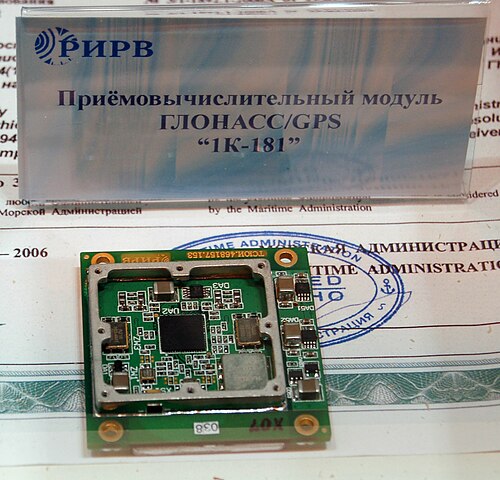
A GLONASS receiver module 1K-181

Screenshot of GPSTest application showing GLONASS satellites usage in South Tangerang, Indonesia (2025)
Clickable image, highlighting medium altitude orbits around Earth,[a] from Low Earth to the lowest High Earth orbit (geostationary orbit and its graveyard orbit, at one ninth of the Moon's orbital distance),[b] with the Van Allen radiation belts and the Earth to scale
A combined GLONASS/GPS receiver, ruggedised for the Russian military, 2003
A combined GLONASS/GPS Personal Radio Beacon
The Glonass-K spacecraft model
A map depicting ground control stations
A Russian stamp with a GLONASS satellite, 2016
A GLONASS receiver module 1K-181
Screenshot of GPSTest application showing GLONASS satellites usage in South Tangerang, Indonesia (2025)
History Of Glonass
GLONASS began in the 1970s when scientists in the Soviet Union wanted to make a navigation system 🚀. The first satellite was launched on September 12, 1982, and was called "GLONASS 1." 🌌 By the early 1990s, there were enough satellites to provide global coverage. The system faced challenges during the 1990s due to the breakup of the Soviet Union. However, Russia worked hard to improve GLONASS. 🌟In 2011, it became fully operational, and now people all over the world can use it for navigation! 🗺️
Future Developments
GLONASS has exciting plans for the future! 🌈Engineers are working on newer satellites, which will have even better technology. These new satellites will be smaller, sleeker, and more efficient! 🛰️ They will also carry advanced technology to improve signal strength and accuracy. More satellites will be launched, resulting in better coverage for remote areas. 🌍Additionally, scientists are researching how to combine GLONASS with other navigation systems for even greater benefits! As technology advances, who knows what fun new features they'll come up with next! 🤖
Applications Of Glonass
GLONASS is super useful for various activities! 🚗People use it for driving to new places, finding beautiful hiking trails, or even navigating the ocean while fishing. 🎣It helps in emergencies, guiding ambulances and police to help people in need! ⛑️ You can find GLONASS in smartphones, cars, and even ships! It's also used in farming to help farmers plant and harvest crops more efficiently. 🌱In aviation, pilots rely on GLONASS for safe landings and takeoffs. 🌬️ Its impact is felt everywhere!
Impact On Transportation
GLONASS has made traveling much easier and safer! 🚀Thanks to satellite signals, vehicles like cars and planes can navigate routes without getting lost. 🚗✈️ Taxi services and ride-sharing apps rely on it to get you to your destination quickly and efficiently. 🚖Even boats on the ocean use GLONASS for safe travel! 🛥️ In cities, traffic management systems utilize GLONASS to reduce congestion. 🚦Overall, it's helping everyone stay on track and make travel fun and efficient! 🌅
Technical Specifications
GLONASS satellites are special machines that help us find locations. 🎯They orbit about 19,100 kilometers (11,800 miles) above Earth! Each satellite can send signals to Earth, which are collected by GPS devices. ⌚Each satellite has a unique ID, and they work in groups to cover all areas of the planet. GLONASS uses different frequencies to ensure accurate signals, making it reliable. 📡It updates every second and sends data about time and location very quickly. The system can locate a person within 2-5 meters, which is really precise! 🥳
Challenges And Limitations
Like any system, GLONASS faces some challenges. 🌩️ Weather conditions like heavy clouds or storms can sometimes block signals. 🌧️ This makes it hard for devices to find your exact location. Additionally, urban areas with tall buildings can also cause problems, creating "urban canyons" that block signals. 🚧Another challenge is keeping the satellites updated. They have to be regularly maintained and replaced to remain accurate, just like how we need to take care of our toys! 🧸But scientists are always working hard to keep improving GLONASS! 🌈
Global Coverage And Accuracy
One of the coolest things about GLONASS is its global reach! 🌎The system can tell where you are almost anywhere in the world. With at least four satellites visible at one time, GLONASS provides high accuracy. This means it has a margin of error of only 2 to 5 meters, which is super close! 🎯Some people can even get better precision when using GLONASS with other navigation systems, making it easy to find our way. So whether you're in a big city or a quiet park, GLONASS can help you navigate! 🗺️
User Equipment And Integration
Many gadgets today can use GLONASS technology! 📱Most smartphones and tablets can connect to GLONASS and GPS at the same time, giving better service. Cars, boats, and even drones have special devices known as receivers that interpret GLONASS signals. 🚗🚁 These devices work together with satellites to find your location anywhere. Some sports watches made for runners and cyclists also use GLONASS to track where you are during a race! 🏃♂️ As technology keeps improving, more devices will be able to use GLONASS! 🎉
Comparison With Other Navigation Systems
GLONASS is one of several navigation systems around the world! 🌍The most famous one is GPS, created by the United States, while there’s also Galileo from Europe and BeiDou from China. 🛰️ While GPS has around 31 satellites, GLONASS has about 30. Both systems can be used together for even better accuracy! 📈GPS works best in the USA, while GLONASS is better in Russia and parts of Europe. Using more than one system is like having two amazing treasure maps instead of just one! 🗺️
Glonass Quiz
Learn more about Glonass
