Gerardus Mercator Facts For Kids
Gerardus Mercator was a Flemish geographer, cosmographer, and cartographer known for creating the Mercator Projection, revolutionizing navigation and mapping.

Do more with AI
Introduction
Gerardus Mercator was a famous mapmaker from Flanders, which is in modern-day Belgium 🇧🇪. He was born on March 5, 1512, and died on December 2, 1594. Mercator is best known for creating detailed and accurate maps 📜 that helped explorers find their way around the world. He used science and mathematics to make maps more helpful for sailors. One of his biggest ideas was a special way to project the globe onto a flat map, which we still use today! Mercator’s work changed how people understood geography 🌍 and increased the adventure of exploring new places.
Images of Gerardus Mercator

The playwright and teacher Georgius Macropedius


Georg Cassander (* 24. August 1513 in Brügge; † 3. Februar 1566 in Köln), deutscher Theologe

The Portuguese (Lusitanian) and Spanish hemispheres of the globe of Franciscus Monachus, following the Treaty of Tordesillas of 1494.

Gemma Frisius by Maarten van Heemskerck
![The terrestrial globe of Gemma Frisius showing, in the south Pacific, the cartouche containing the dedication to Charles V and the publishing rights of Mercator.[t]](https://upload.wikimedia.org/wikipedia/commons/thumb/8/86/Gemma_Frisius_terrestrial_globe_%284%29.jpg/960px-Gemma_Frisius_terrestrial_globe_%284%29.jpg)
The terrestrial globe of Gemma Frisius showing, in the south Pacific, the cartouche containing the dedication to Charles V and the publishing rights of Mercator.[t]

Cultural References
Gerardus Mercator is mentioned in many books, documentaries, and even in video games! 🎮Some stories about explorers reference his maps as essential tools for their journeys. You might even come across his name in geography classes, history texts, and on various maps you see today 🌏. His influence on navigation means that many people know about him, even if they don’t realize it. He represents adventure and discovery, making him a well-known figure in both history and pop culture! 📚➕🌍
Impact On Geography
Gerardus Mercator had a huge impact on geography. He helped people understand how to navigate the world, making exploration more accessible. His maps allowed people to study continents and oceans, leading to more discoveries and trade 🌎. Mercator's work inspired future mapmakers and geographers, creating a foundation for modern cartography. Today, we still use his ideas to create maps! Mercator's influence is seen not only in maps but also in how we think about space on Earth and how we relate to each other in different countries. 🌍✨
Later Life And Legacy
In his later years, Mercator continued to work tirelessly on maps and globes. He lived in Duisburg, Germany, where he created many ingenious maps, including some famous ones of the land of Europe 🌍. Mercator was respected as both a teacher and a cartographer. He passed away in 1594, but his legacy lives on! His ideas and maps are still taught in schools and appreciated by geographers and adventurers around the world. People often say if you want to explore the world, you must know about Mercator! 🌟⚓
Works And Publications
Mercator wrote and published many books about maps and geography. One of his important works is "Atlas," published in 1595, which collected maps of different regions 🌍🗺️. This helped people see and understand the world better, and it's where we get the name "atlas" for collections of maps! He also created globes, showing the Earth’s surface in 3D. His maps weren’t just pretty pictures; they were filled with information, helping everyone learn about geography and navigation. 📖🎓
Influence On Navigation
Gerardus Mercator changed how people navigated the seas. Before his maps, sailors often got lost or didn't know where they were. His accurate maps made adventures much safer! ⚓Sailors could plot their courses using his maps and reach new lands without getting lost. The Mercator Projection meant they could sail in straight lines, making it much easier to travel long distances. His maps were so useful that many were printed and widely shared, helping explorers discover new places and cultures. 🌎✨
The Mercator Projection
The Mercator Projection is Gerardus Mercator's most famous map-making idea. Imagine wrapping a piece of paper around a shiny globe 🌐. The projection helps us see the Earth on a flat page, but it makes some places look bigger than they are. For example, Greenland appears huge, but it's actually smaller than Africa! 🌍⏬ This projection is super helpful for sailors because it keeps angles straight, helping them travel in straight lines. His projection is still used today for many kinds of maps, including maps on your phone! 📱✨
Early Life And Education
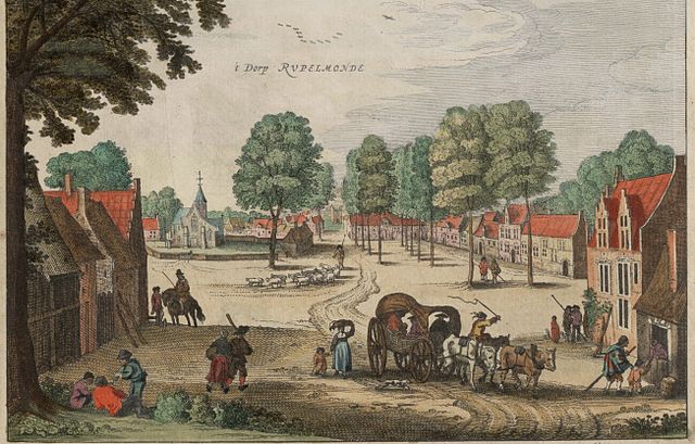
Gerardus was born in a small town called Rupelmonde, where he loved to study nature and learn new things 🌱. He went to a local school where he learned about math and astronomy. Later, he studied at the University of Louvain, where he became very interested in maps. Mercator worked as a teacher and taught others about geography. As a young man, he traveled to different cities to learn more and improve his map-making skills. His education helped him become the amazing cartographer we remember today. 📚✏️
Criticism And Controversies
While Mercator is praised for his contributions, some people criticize his projection for distorting the size of continents. For example, it makes Greenland look very large compared to Africa 🍏🌍. This led some geographers to call for the use of different map projections. There are many other ways to show the world on maps! 📜But even with these criticisms, many still celebrate Mercator for his amazing work, and his maps remain popular tools for navigation. Mercator’s legacy continues as we explore new ways to understand our planet! 🌐💡
Contributions To Cartography
Mercator made many important contributions to cartography, which is the art of making maps. He created detailed maps of continents, countries, and oceans 🌊. His famous 1569 world map was revolutionary! It helped sailors navigate across the seas with more accuracy than before. Mercator was one of the first to use a grid system on maps, which divided areas into smaller sections. This made it easier to find locations. He also studied the Earth’s shape and how to represent it on paper ⏹️. His innovations made him a legend in the world of maps! 🌟
Gerardus Mercator Quiz
Learn more about Gerardus Mercator
